Sunday 1 October 2017

Squeezin in at Sandy


September 15-17

Watching the weather during the week, it wasn't looking too promising. However, Thursday night, Leo and myself decided we would head for Sandy Cape on Friday afternoon and take the risk of the now predicted light showers and just live with it. Leo got off work early on Friday and I met him on the road about 1430. The plan was to head up to Jurien, have dinner at the pub, move onto the campsite afterwards and just take what comes from there.

Discussing the weather over the radio, I asked Leo to put his money where his mouth is. A pint was no on the offering for me should it rain. I would be buying if it didn't. Leo also wanted to play a game: how many cops would be see on the way up. Another pint on offer to the one who scores correctly. Against my better judgement, I elected 2, Leo, 4.

We arrived in Jurien about 1700. A slow trip up, we got stuck behind a line of half a dozen vehicles following a booze bus doing its legal speed of 100Km/h. Being the cops, no one would overtake it....go figure! which meant we had a leisurely stroll up the highway for about an hour. Time being on our side, it wasn't an issue anyway. But with 2 cops seen, I was feeling pretty chuffed - a free pint was coming my way. Winning!

Leo having never been north of Lancelin, I showed him a few bits of Jurien. It was way too early for dinner and we had some time to kill. But after an hour or so at the boat ramp, the sun getting closer to setting, we decided to forego the pub dinner, buy something to cook for tea at the local IGA and head on out to camp in time to watch the sun set over the ocean. And a good idea that was too. Leaving town, we were tested by the slow moving booze bus. The female copper laughed when I told her we had been stuck behind her for the last hour.....Oh the irony.

Arriving at Sandy Cape, the place was heaving. It just seems to be getting more popular as time goes on. I guess, with the restrictions Dandaragan Shire has put on free camping on the coast, then the very few legal places to go will only get busier. We managed to squeeze into a spot for the night, a mere 50m from the beach:


As is quite often the case in a public campground, you have no choice over your neighbours. A large group across the road was carrying on a bit, swearing, driving around all night and just generally being a pain for others. The neighbours in the van next to us made some comments about them earlier on to us. All in all, it could have been far worse than it was. By 11pm, with a few beers and reds under the belt, we retired for the evening. Not a bad effort for me, seeing as I had been up since 0330.

I was woken about 0600 in the morning. The sounds of Leo snoring and the dew raining down on my swag had pushed the bladder into action. Peeling back the covers of the swag revealed a pretty amazing sight:


Fog. And wasn't it thick:


I took a stroll down the beach with the camera. You couldn't see either the South nor the North heads:


Killing time for an hour or so, Leo decided to raise his weary head. The underside of both our awnings were as wet as their tops. So we had a slow relaxing morning, waiting for things to dry out. It was about 1030 when we had finally cooked breakfast and packed up for some explorations for the day. At this stage, we hadn't decided where we would camp tonight. We would just wing it and see what the day had in store for us.

First port of call for the day was to take Leo out to one of my fave little places: Stockyard Gully Caves.


A relatively minor track to get in, I was surprised by the amount of cars in the car park. I had never seen so many. Donning our caving gear, we headed off down to the gully.


The bee hives at the entrance creating quite a loud buzz in the air:


And into the cave we go:


A flat walk on soft sand inside of some 250-300m, and pretty soon you are in complete darkness. Turning of ones head lamp and taking in the blackness is a surreal feeling. As you will see in my vid, I mention the bad habit of souveniring cave flow structure. I know it happens in other caves and I find the practice abhorrent. However, upon reflection, I have to admit, some (most?) of this damage could well have been caused by flood damage. You see, the cave is really just a tunnel. Its a creek bed, and in times of high water (no doubt that was some time ago), then it could well be possible these structures were removed by water and debris. At times gone past, the whole "tunnel" could have been under water.

Anyway, this time around I found evidence inside the cave that some movement monitoring is going on:


And before you know it, the rays of daylight start poking your eyeball's:


On a hot day, its a remarkable place down here. The river gully, vegetated with large gums is a cool little oasis. The vegetation so far removed from the scrappy salt bush that lines the coastal plains in this area.


The cave itself also provides great relief from the flies and heat on a hot day. With a couple of hours of exploring done and lunch now baking in the oven, we hit the track out, this time heading for Green Head.


Arriving in Green head at Dynamite Bay, the Pie and Chicko roll was ready for the Eating.


Poor old Leo had to go to the store for lunch and had a chocolate ginger scone with a choc milkshake to wash it down. Yuppie! A nice little store it is too, if you are in town, I recommend it.

From there, I took Leo up towards a little tourist track to see some of the other coastal scenery about the place. Venturing in to the new Milligan's Island camp ground to see if that's where we would like to spend the night. Quite different to the Cape, there was no one here. Whilst it seemed a nice, new campground, it just didn't have the appeal of Sandy so we decided we would venture back there for the night.

We drove down to the beach and spotted the most amazing contrail. A B777, on its way to Singapore at 36,000Ft, leaving a phenomenal contrail and a black exhaust plume parallel to the cloud. I've never seen that before:


From there we headed out to Point Louise:


Time now starting to get on, we decided its best we head back to camp in time for the sunset. However, a drive along Anchorage Bay back to Green Head was in order:


Returning to Sandy Cape, we found the place to be even more packed than when we left. With slim pickings to choose from, we managed to squeeze into a small site among the vegetation:


And just in time to grab a beer, a camera and a GoPro to watch the sun go down over the Indian Ocean:


Dinner again a simple affair. A pre made chicken parmigiana, garden salad and some dressing. Too easy:


However, once the sun went down, boy did the mozzies come out to play. Over a few drinks, leo decided to look up the International Space Station to see where it was. With pretty flakey coverage, He turns and says, would you believe its right above us......No way, I shit you not. So out into the darkness we ventured and watched as the space station zoomed on by. A Cosmonaut and an Astronaut or two, flying over, right above us, some 400Km above. Here we were wishing we could be where they were, and here they were wishing they could be where we were!


Come the morning, we helped a couple with some issues trying to fill their water tank on a rental troopie, packed up and headed for home. Leo made note of the fact he was now due a pint, due to the fact no rain had fell over the weekend. So, with that and the cop bet, we ended up even.

The only really thing of note coming home, was coming across an accident scene with a lucky escape. An older lady, trying to open a drink bottle, lost control in the dirt, spun and crossed to the other side of the road, backwards, burying the commodore arse end in the dirt. A lucky escape, a fella towing a boat coming the other way, only just missed her as she reversed out of control right in front of him.....


So a nice couple of days adding to the nights under canvas, now at 29 nights for the year.

A measly 560Km weekend, 210Km from camp to home, made it a pretty easy weekend. One we both dearly needed, since it had been nearly 3 months of being locked in at home and work since we had last been away.


The Tab seems to be doing the job nicely and the multi odometer function is a handy novelty.

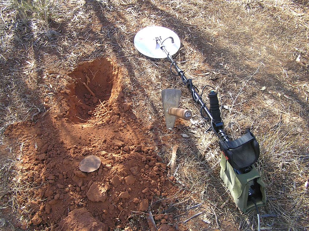
In a month, I get a week off, so I'm thinking I may go and have a ferret again with the detector. Will this be the time I pop my nuggetty cherry???


And the trip vids:

part I-


and part II-


Thursday 20 July 2017

Get lost why dont ya!

So I have been asked a bit lately what would I recommend in regards to sat nav in your vehicle. Would I recommend a hema such as the HN7, a tablet, an Ipad or some other device.

Well at the outset, I have to say I have absolutely no experience with any apple product, nor do I plan to. Too many handcuffs for my liking. But those that have them, love them, so there must be something of worth there.

Since 2009 when I first set up an incar sat nav (and I'm not talking Garmin Nuvi's, Tom Tom's, Navman's and other street routable portable devices), I went with the good old PC, running various operating systems and had the output linked to an external monitor.


That has served my purposes very well, although it does come with some hangup's. Like trying to change mapset's on the move for example. Its almost impossible to do, and cant be done safely IMO.

But I've never been lost and have recorded some great data over the years. For example, my track logs from 2009 - 2015:


After my Canning Stock Route trip, the old 10" netbook hard drive running XP was starting to play up. I'm surprised it lasted that long. That poor old hard drive had been beaten to a pulp from off road corrugations for years without issue. The Canning finally sorted that out - not to mention the other vehicle damage suffered.

So I replaced that 12 months ago with a 14" lappy with SSD, running windows 10.  That has brought me up to the modern era. But I'm getting over trying to get touch screen drivers to run on Win10 effectively. That allows me control over my mapping program from the onitor itself - the laptop is buried under the seat.

Since 2009 my software of choice has been PC ozi explorer and I can get my way around this  reasonably well. Its pretty full on for the novice, but in reality, its not that hard to master most functions you would need to use for off road navigation with a bit of practice.

Some years ago I also purchased a cheap Chinese 7" street navigator running a WinCe platform, purchased a licence and put ozi on that. That wasn't too bad, Having 2 navs running at once, displaying different map sets of the same location can be handy. Its been sitting in my glove box since my old car failed on me though in 2015.


Over the years, I've purchased a lot of ozi mapsets. So to stick with what I have is a no brainer - unless someone can show me a better alternative for my map set library I've built up, primarily in ECW and various Ozf formats. 

So that brings me to the question that's been asked of me: what mapping platform to run? 

I recommended an android tablet. The reason being, its far cheaper than a hema (if you already have maps that is - and most maps aren't cheap) and far more versatile. Not only can you use a tablet for navigation, but there is a whole world of apps out there to cover almost any need one could have. The hema can't do that. And if you buy a 3/4G capable unit or have access to wifi, then you have the world of the webs at your finger tips too.

So, not to rest on my laurels, I put my money where my mouth is and went out and bought a tablet, specifically for this purpose. I'm unsure how this will go in the future, so will just have to give it a shot. With the PC, I've saved all my files as a GPX file. This allows me to save both waypoints and tracks in the one file. I can also exchange it between different platforms and import that into Google Earth if needed. However, Ozi android, still after all these years in development, cant handle .GPX files. So to make my older files usable on the tablet, I'm going to have to save both waypoints and tracks as separate files.

It can be very handy when in an area you have been to before and cant seem t find your way. Uploading previous saved tracklogs can be a godsend when you cant find your way. So that is one issue I will need to contend with. 

Onto the Tab. I already have a quality sSmsung tab with 4g . But I want a stand alone tab for my nav and my 8" Samsung isn't big enough for me. So enter a lenovo tab3 10 business. On special at the Good Guys atm for $200. Here is where I strike my biggest drama's. trying to find out if the tab has 2 features I need

1. a stand alone GPS
2. A magnometer (compass)

In the past, asking salesmen these questions was a mission in futility. They haven't a freakin clue.

Funny how things don't change. 

The salesman was getting a bit irate at my barrage of questioning. I said, if you can confirm these features you have a sale, if you cant, I have to walk. I must have spent a couple of hours with him. He tried to tell me it only had a-gps (needing an internet connection) and if it didn't have Glonass in the specs it wasn't stand alone. So I told him that's crap and he should google Glosnass - a Russian GPS constellation

https://en.wikipedia.org/wiki/GLONASS 


Anyway, with no Glonass in the specs, he wasn't keen to sell it to me. After searching numerous sites for specs on this tab, we agreed it probably did have a standalone gps and I would give it a shot. In fact, is there any tabs out there without a stand alone GPS only A-GPS?? So I saved at least $150 over a similar sized and lesser memory Samsung.

Once home and through the initial set up, I downloaded a GPS status app. And my fears were quelled. It did have stand alone GPS - phew. But no magnometer (compass). It would have been nice to have that magnometer, but for nav purposes isnt' required, so I can live with that. Funny though the lower spec 10" Lenovo showed an electronic compass.  And Android 5.1.


It might have been a better bet in hindsight. I forgot I had read that with Android 6 (the OS of my new tab), writing to SD cards had been disabled and provided some difficulties. I recalled this when I went to play with the new tab and found some issues. So to get around this, I have mounted the 64Gb card as internal storage. I can still transfer files with USB transfer on the PC to the card so all is not lost.

Anyway, teething issues sorted, I payed my $32 for an OziAndroid licence key and got that up and running with my truckload of maps. The GPS can be a bit flakey at times compared to my gps module on the PC, but it is good enough. I suppose I could go buy a bluetooth gps module if I dont like this flakiness at some stage in the future:


I then installed wiki camps to the tab, another valuable feature of using a tab:


My next task was for street nav routable maps. I was going to go with Igo - somthing I'm familiar with, but getitng no response from a vendor made me think again. My mate Woody, who was one who asked me which way he should go, put me onto here we go (formerly here maps). A free app with a free map download for off line usage.


I tried it out today, and although I knew where I was going, it seemed to do the job, even when I deliberately veered onto a different route. Like all rout-able street maps, sometimes you scratch your head where they take you. I've always said, it pays to look at a map first and rough plan your route.

So, to make this a going concern, I had to sort out mounting it in the car. I went the ram mount option. A seat bolt flexible pedestal, with quick release tab holder. Not a cheap option at $120, but it should do the job. I put a brace on the stem to help sort some of the movement this will produce when in the rough - mind you, I had a heavier monitor on a different stem and never bothered with the vibration in the past.

I was always planning on running this in landscape. However, it seemed to encroach too much into the passenger area for my liking, and a 10" tab provides plenty of field of view in the East-West plane, so my decision was made. Portrait it shall be:


It doesn't encroach too much on the passenger area, so that is a good thing too:


And I can easily turn it out of the way to gain full access to radio and climate controls when needed:


With a world of apps available to download, it makes the Tab a much better proposition to a hema or the like IMO.


But that said, I already own my maps. If I had to go buy them from scratch, the Hema or the like may well represent better value for money. So this is where I'm at at the moment. A total outlay (excluding maps) of $400 has me up and running. Now I just need to get out there and use it and see if I can cope not having the functions full blown OziPc had.


EDIT: 11/08/17

I mentioned the internal GPS seemed a bit flakey. By that, I mean I could see the speed box on Ozi didn't seem accurate at times and even sitting on a constant speed it would show speeds that obviously were not correct. So I decided to see how an external GPS would fix that issue.

So enter the Globalsat BT-821 bluetooth module. I went the BT-821 route over the others for a couple of reasons. 

1. It was about the cheapest and I didn't want to spend a motza proving a concept
2. it wont work with Apple products. I have none anyway and don't plan on ever owning such
3. It has excellent battery life over the others if I don't want to power it on the go


I feel if money wasn't an option, I would have been keen on the Garmin  GLO. Although only having about 1/2 the battery life, it also connects with Glosnass. More sat's to connect with should mean greater accuracy?? But its also twice the price.

garmin GLO

The BT-821 only connects to the GPS sat's and a major downer is the only charger supplied is a car charger. Due to it having a 4.0 x 1.7mm jack plug, it wont accept standard usb cables. However cheap solutions for that can be found and I will be able to charge it inside once this cable arrives.

It was very easy to connect it to the tab and to ozi  android. So I took it on a run for about 100Km's on a route I initially tested it on where I found that "wobbly" speed issue. Wow, what a difference the BT GPS made. The speed function was now so much smoother and accurate and it held fix for longer in places where the internal one just dropped out. So I think I will be running the BT module as a permanent set up now. Whilst viewing the sat page on ozi didn't seem to show any increase in the number of sats or HDop between internal and BT gps, field results show it to be much more stable. I believe the recorded track will be much more accurate now.

Which leads to a question: do you need to buy a tab with internal GPS if you can just connect an external BT unit?  I suppose the additional cost of a BT unit would have to be taken into account to answer that question.


 One reservation I had about running ozi android over the pc version was compatibility of all my recorded logs over the years. I save them in .gpx format as this allows me to save both the track and waypoints in the one file. Unfortunately Ozi Android doesn't support this function in full.

You can load waypoints from a gpx file, but not tracks. So I was given a lead about a converter program. Thanks Maurice!

Ozi track converter 

I downloaded this program and gave it a trial. It is very easy to use and will extract a track from a .gpx file and save it as a .plt file, which then can be used in ozi android. So to save me some work extracting tracks from my .gpx inventory, I will just leave this app in place and should I ever need to view an old track log, I will just convert it in the field as required.

Winning!


Watch this space. 

So with the first trip now under the belt (squeezing in at Sandy): some observations.

The Tab and ozi android seemed to do all I needed. My tracklog was recorded fine and I was able to put this into the PC version to combine all daily logs as a complete trip and saved as a .GPX file.

The biggest drama was trying to export the one waypoint I had saved and then finding it. Playing around with the config menu, I set the saving folder to default. Eventually, I could find the file. I'm not sure if this was an issue with coms between tab and PC or I just screwed something up. I guess I need to have another play on my next trip.

Sunday 2 July 2017

How to make a small fortune


19-25th June


So another year comes and so does another attempt at finding some Yellow. Meeting John at the leisurely hour of 9am, because we are not travelling as far this year, we headed off to the Bakehaus at Bindoon, to meet the third of the Party, Bruce. Bruce was coming from further South, via a different route to us, so the Bakehaus made the perfect meeting point. And I got to have a coffee and breakfast whilst we waited.

Stopping for fuel at Wubin, we had another 100 odd Km's before we turned off onto the dirt for a week of hunting for precious mineral:


An interesting article on Gold can be found here:

uses-of-gold


I was given a lead earlier in the year where some alluvial had been found. As time drew near, I wrote to the tenement holder seeking permission. I never received a reply from that. Lucky for me, I also wrote to another tenement holder nearby, and they gave us the permission to have a look around their exploration lease. A big thank you goes out to Minjar Gold for allowing us to have a look around their lease.
http://www.minjargold.com.au/

So the die was cast.


Another 50 or so Km's on, we then turned onto a mining track to seek our camp for the week. Having a spot marked that we spied on Google Earth about 6 Km up, it wasn't that impressive, so we went exploring. About 2Km South of that spot, we found a suitable place to camp up for the week. Although I was quite alarmed at the amount of vegetation. Pushing through this with a detector would be very hard work indeed:


Whilst making camp, or more likely, having a beer by the fire, John went off in search of some way points he had marked, some 600m away. When he returned, he said he had found an old shaft and the country opened up considerably. That was great news to hear. A relaxing night by the fire and we all retired to noddy land for the evening.


I surprised John the next morning, being up before sunrise. Unfortunately Bruce had issues with his hand held GPS. These issues we never resolved for the trip. This would put Bruce on the back foot, because there is no way you can venture into this country without GPS. Not if you want to return that is. So he had to stick to visual navigation, which meant he couldn't venture into the scrub like John and myself did. A late start after some coffee and breakfast, John lead the way, through the thick scrub where he showed us the mine he found yesterday:


lots of open ground was presented  to us, so we all headed off in different directions, with radio contact to make our fortunes.We would use this mine as our meeting point when we worked the area. A few hours in and we returned to Ground Zero (GZ) to swap tales of all the junk we had found. We hadn't found a lot in all reality, which in some ways is a bonus. But a nice piece of yella wouldn't go astray. The hair thin pieces of wire, about 10mm in length was a pain. I found a few of these over the week. Also, digging a fair hole for a target turning out to be a can lid was depressing:


A small rest and a bite to eat, we headed out again to make our fortunes. the ground showed promise:


 But it wasn't to be. Returning to GZ, it wasn't to be for the others either. So we made the 600m trek back to camp where John proceeded to cook a roast. Having half a lamb, he fed the lot of us. Thanks mate, it was delicious:


Over breakfast the following morning, we decided the ground we worked yesterday looked good and we should return. More so because it was open. There was no way you could detect most of the ground in this area, the vegetation just being so thick. Open ground was good but I was unsure. Whilst there were some nice patches of quartz, there was also a lot of banded iron and iron stone about. Not that I'm an expert, but I think there was just too much iron for good alluvial finds.

So we made our way to GZ and set up for another day of detecting. I decided I would push on for the base of a hill to the West. At first the ground was open, then the vegetation started. Ducking and weaving, trying to find a clear path was a chore. And bugger me, a good Km from GZ, on the slope of a hill full of vegetation, I found evidence that someone had detected before me. Its got me beat. No matter how far you venture, you always find evidence of someone being here before you. Its bloody amazing.

So I returned to GZ to meet the others. A bite to eat and John said he would show us some more workings he had found in the morning stint close by:


Lots of hand dug holes here. The trench above was impressive, that would have taken some work. We mused on what made them dig there in the first place. Had there been alluvial finds here in days long gone?  We decided to return to camp and take the vehicles for a drive to assess the territory. Bruce's car needed a run anyway. He was running a fridge, on one battery, with no capacity to recharge it.

So off exploring we go. First stop was the breakaway where we were supposed to camp at:


And then we checked some old activity nearby. I was planning to head up to a couple of inactive mines I had marked up by Chullar Hill, about 20Km's away. That hill can be seen clear as day from the breakaway:


Along station tracks we go, coming to an old bore:


The sign on the stock holding fence proving they are a funny bunch out here:


Continuing on, we came to an active mine site and had to cross their haul road. The tracks on my maps don't quite match the route we are travelling, no doubt, changed by the recent mining activity. It's now 1530 in the afternoon and I'm worried about getting back to camp in time. So we can the idea of old mines exploration and head South for camp. We come to the junction of the Midday track. Bruce wasn't keen - he reckoned it was overgrown. Apart from a couple of acacia's at the start, it looked fine to me, so we ventured on. Camp only being some 11Km away. Unfortunately we only made 650m on this track before it closed in. So a complex turn around manoeuvre had us going back the way we came. So our 11Km shortcut got turned into a 26Km back over the same ground grind. We arrived back to camp just before dark and proceeded to get dinner on the way. Another nice night by the fire with desert from John - lemon crisp biscuits. You must thank your wife for that, it was a great choice.


Our third day on the ground, we headed South from camp in the cars looking for ground. Coming across some interesting stuff, we parked up - in the shadows of another old working. I headed East for some 750m. Coming down a hill full of ironstone, I reached the flats where in times lots of water flowed. After a couple of hours with no prospects, I decided to head back to the car. Just in time too, the weather was changing rapidly and it looked like rain. I just made it to the car before the first sprinkles set in. That's as bad as it got though. The wind was certainly increasing and the cloud looked ominous.


John had a find on the track, close to the car. It took him a bit just to get it out the hole, then he had to find it. I tried to tell him, on a track, adjacent to old workings was not a good sign. But he followed through (as one should)

That event was recorded here:


Funny as.......not!

For the second stint, I made my way towards the boundary of an existing lease. Once off the hill the ground showed reasonable prospect. But again, the precious stuff alluded me. With the cloud now pouring in, I made my way back to the car.

Returning to camp at a decent hour, I got the camp oven under way. Yet another bloody roast. We had 3 roasts in total on this trip:


And whilst the weather was threatening, we only got 3 small showers...that lasted all of a couple of minutes for each. Perth had been hammered, so we dodged a bullet.

The fourth day on the ground, and we were getting a little disheartened. We took the cars out again. I mentioned that track that passed by GZ must come off the main track. We headed out to the main road and came across what was obviously either an old miners camp, station workings or both. Evidence of cans suggest to me old mining camps. Evidence of ruined buildings suggest station outposts. So I believe it's a combination of both:


We crossed to the other side in search of ground. Lots of rubbish here would make detecting a pain, so we head back North . With a bit of looking around and we found the track which passed GZ. We proceeded past the old workings (GZ) and ventured a bit further North, again stopping at some good looking ground. But alas, we came home empty handed.

Bruce, being stuck to the track having no GPS found a lot. A lot of nails, tacks and other assorted bits of junk. John and myself remarked on the lack of wildlife. We saw no evidence of anything other than birds. Even their scats were few and far between. Though this brings the detectorist some advantage. No wildlife = no bullets.


John remarked by the campfire, he had decided to leave a day early. He would go home solo tomorrow. Bruce and myself would stay another day as planned.

John departed about 0930 whilst myself and Bruce went in search of ground. I had noted some interesting looking ground out by the main road, so out there we went. On the way I decided to stop in on a mining lease, which was about 2km from our camp. I was surprised to see an active site, some boys on the drill rig hard at work:


Although there was no "no entry" signs anywhere, we didn't hang around. We didn't want a warning shot over our heads. I'm sure if we were sighted they would have been not to happy. Such is the breed out in these parts.

Back to the track which leads to the main road, I spotted some old workings, so we ventured in to investigate. Wow, a lot of work had been done hear some time ago. A hand dug trench about 1.5m in width at the top, going some 50m in length with a depth of about 10m. Bloody hell, I thought the trench near GZ would be hard work. This was something else again. And around this trench was a few other shafts that had been dug.


But sight seeing was not our main aim, so we found some ground out off the main road and once again, unsuccessfully prospected for a couple of hours. Then proceeding back to camp, again on some nice open ground, we had our last stint for this trip. The yellow was elusive. We came back to our last campfire richer for the experience but not for mineral wealth. I'm starting to set a trend here and I need to get this monkey off my back.

Lucky for us, John had brought some prior found samples for us to google over, or we would never have seen any:


Having to water the plants at 0330, I decided to have a crack at some star trail photography with the GoPro. Unfortunately, with both phone and GoPro batteries flat, I had to gin around for about an hour before I retired back to the swag. I let it do its stuff. Set on 30 second exposure and continuous night shooting mode, the GoPro took lots of pictures.

And I got some interesting results on reviewing the recording once home. First up, I plugged in a power bank to keep the camera running. For some reason, this didn't work and the GoPro battery went flat whilst the powerbank didn't discharge. So I have one problem to look into. Secondly, I think if you are to dabble in this, you need some lit background as all you really see is little dots moving around a black sky. It needs some reference. But I also lucked in. The camera stopped recording just before dawn. This allowed the foreground and sky to be lit. Using some software to compile the images together and form the start rail I managed to get this remarkable shot.


Beginners luck I reckon. But it showed me why I need some partially lit background. I will definitely try this again.

The compiled images made the following clip:


So with coffee done it was time to pack for home. On the track out at 0930, I told Bruce I would wait at every turn off point so he didn't get lost. With no GPS nor UHF he would need my guidance. The plan was to head to Watheroo and have lunch at the pub.

Hitting the main road, I waited. And I waited. And I waited some more. After 15 minutes with no sign of Bruce, something must be wrong. The track was only 6Kn long after all. So I ventured back up in search of him. Only 500m up, he rounded a corner, flashing his lights. Bout time! So I reversed into the bush to turn around. Bruce came up to my window. Yep, he had an issue....Bugger.

Upon leaving camp, he realised he left his camp mug behind, so he reversed back to grab it. Straight into a tree....Grrrrr

He was not a happy man, as one would expect. A damaged bumper, tailgate and rear canopy window shattered into thousands of pieces. Worst of all, we had all this dirt to travel and the back of his ute would hoover this dust, straight into his tub. So we made the only decision. We canned the pub. The least amount of gravel was the way we came in 7 days ago.

You had to feel sorry for the bloke. I scratched his car (once again) and now he had all this damage to sort out. Worst of all, he was planned to go away again the next week and this damage would make that journey a chore.


Arriving in Wubin, we got our first real phone coverage for a week. Txt messages going off, one was from John. He too had some adventures. 5 minutes from home (which was a lucky break for him), the car started bellowing black smoke. He got the camper trailer in the driveway but that was the end of the ranger. Certainly wasn't a great trip vehicle wise:


3K later, with new injectors the ranger lives another day. I haven't heard back from Bruce how he has got on yet.

So another week long adventure has been completed. Not the way we would have liked, but oh well, at least we were not at work!

So how do you make a small fortune? Well, you start off with a large fortune and take up prospecting. That should turn your large fortune small in no time.


Trip Stats:

6 nights under canvas
920km travelled
107L fuel used
for an average of  11.7 L/100Km
cost of fuel $133
camp fees nil


With Yeagerup, The Anne Beadell, logue Brook Dam, Mukka and now Ninghan complete, (some of those trips not reported here) the running tally so far this year is 27 nights under canvas. It will be a few months now before I can add to the tally.


And the trip video can be seen below: