I had a 4 day
break from work and the weather had been dry, so I decided to leave the trouble
and strife + tin lid behind and do a run to the Goldfields. I haven't explored
much out there myself - my bad - and its a big one on my bucket list. So I
loaded the car and headed off solo for a 4 day cannonball run.
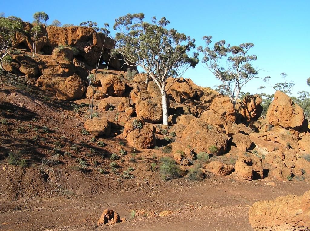
First up was to check some rocks on the way. Turning off at Kelleberin, I made my way up to Marshall Rock. Not that spectacular, but a nice quiet campground is here if required. I picked up a cache and I made my staple hot salami and jarlsberg cheese sandwiches for lunch before heading off to Muckinbudin. Here I had arranged to meet a fella. But alas, by the time I got to town I had missed him by 40 odd minutes. .......So from there I headed off to Baladjie rock.
First up was to check some rocks on the way. Turning off at Kelleberin, I made my way up to Marshall Rock. Not that spectacular, but a nice quiet campground is here if required. I picked up a cache and I made my staple hot salami and jarlsberg cheese sandwiches for lunch before heading off to Muckinbudin. Here I had arranged to meet a fella. But alas, by the time I got to town I had missed him by 40 odd minutes. .......So from there I headed off to Baladjie rock.
A lot more
structure here and a much larger campgound. A lot of evidence at the site said
that this is a well used camp and probably pretty muddy when wet. Another cache
was bagged then it was onto Southern Cross for a fuel top up.
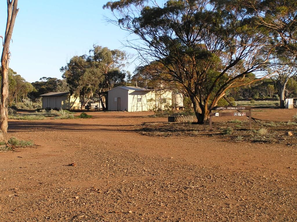
My aim was
Jaurdi Station for the night. I wanted to go via Koolyanobbing, but its a
restricted access westnet rail maintenance road and I didn't have the courage
to go against that. So I went the long way round. I got there under a setting
sun. Driving the road with a setting sun in the eyes was a challenge. I even
missed the homestead in the failing light, but after a double back, I found
ground zero. I had just enough light left to gather some wood for dinner and a
campfire.
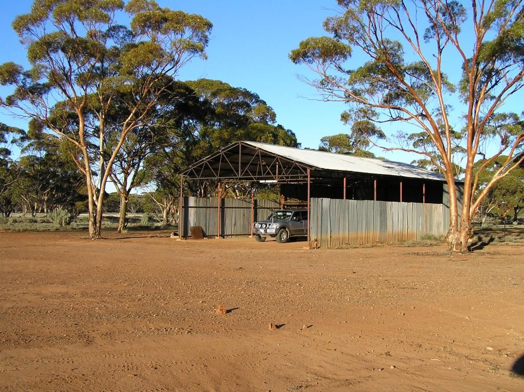
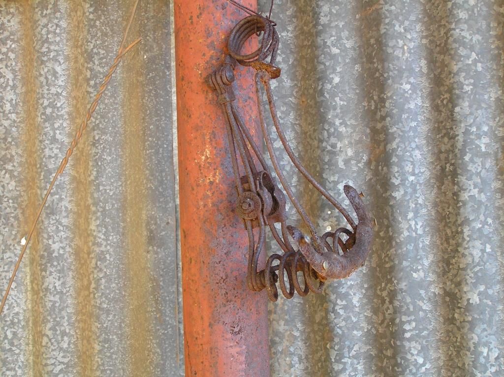
Being tin, and
having a nice cable hole, I was able to stick one of my leds on the side of the
shearing shed and feed the cable through the hole in the wall....Nice....
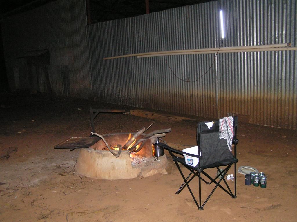
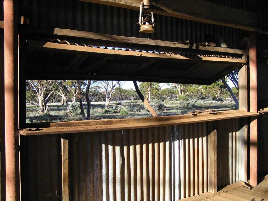
And the view
from the window was just superb
A pleasant night was had listening to the sounds of freight trains in the distance. Dragging myself out of the swag about 7, I slowly got all my chores sorted and finished off with a bowl of cereal. The plan for today was to find a way via bush tracks to the Northeast and park up at Rowles lagoon for the night. I would head up the Mt Jackson road for a bit and then head East on another track to come into the back of Credo Station.
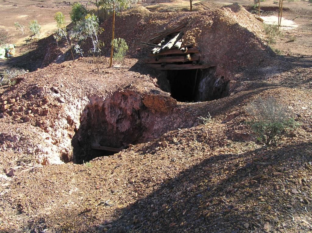
Best laid plans always go astray....Traveling along the Mt Jackson Road was awesome. It was in great condition and I just love that spread out Salmon Gum country. I spied what I thought was to be my first diggings so went in to investigate: Fail......it was a dam, damn it. So I headed further North and spied an old abandoned mine on my gps. I took this track and investigated. It consisted of a gravel pit in a natural amphitheater, surrounded by picturesque hills in the distance and this structure:
I guess that’s where its name of Breakaway Mine comes from.
I had a bit of a look around at the place. A small dilapidated sleeping/crib hut in a bad state of disrepair and a small shed in much better condition. Small electric motors on the bench in the shed, in various states of disassembly made it look like there had been a swift departure made from the place. It was like a snapshot in time. The gravel pit was huge and I had a lot to get through today, so I didn't explore the extremities. I did go and look at a couple of the nearby shafts though. After all that's what this trip is about, rocks and gold...
A couple of shafts that obviously met not that far underground:
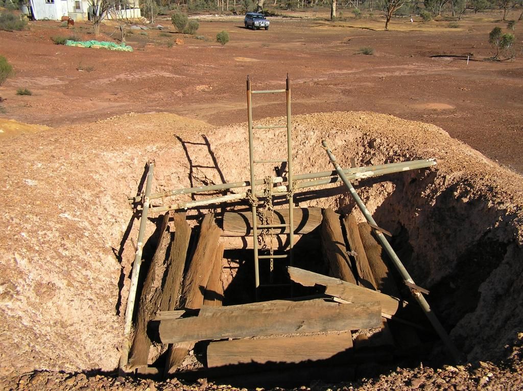
But of more interest to me was this next one. In my "roaring days", I indulged in a bit of caving, so ropes, cave ladders and small holes tend to get me going....The ladder on this one was a pearler, in great condition and chained to rotting old timber holding the walls up. Common sense prevailed and I didn't do it. I was over 100K's to the nearest main road, here by myself and the risk of a bit of adventure much too great, sadly.
So after about 1/2 hour of looking around, I hit the Jackson road again.
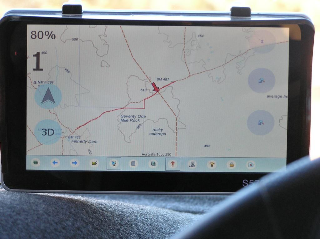
I pushed on, not knowing what may lie ahead. The first navigational challenge came soon afterwards when I got to MT Finnerty. The roads direction and the maps didn't quite seem to correlate. I am running 2 gps's in the vehicle. One is a netbook with external 8" touch screen running Ozi, the other a 7" chinese device running OziCe. I usually just run the 250K topo on the chinese and 100K on the netbook. So I played with the zoom on the netbook for a broader view and selected the correct route. Just goes to show, paper maps are still very valid in this electronic age, not even factoring failing electronics into the equation. I came across what was obviously a haul road. It was marked with no left and no right turn signs. This wasn't on any of my maps. I assumed it was the Mt Walton road. In hindsight, I was wrong. So I continued Eastwards and crossed another larger road with no signage. This one was on my maps. I crossed this and continued on. The further I got, the more the bush encroached. Then it closed right in on me. I gritted the teeth for about 100m listening to the sounds of fingernails on chalkboard , the vegetation against the clearcoat of the Paj. Then I was greeted with a large washout. I parked the Paj where I could get the drivers door opened and had a recce on foot. Whilst negotiating the washout wasn't a problem, if the next 50 or so Km's was going to be like this, not only would it take me an eternity, but what state would my daily drive end up in. Discretion is the better part of valour, so I made the decision to bail out. Reversing out of the enclosed salt bush was a challenge. Almost peeling off the left hand wing mirror. But I got out. Heading back to the last cross road, I spied and took a pic of the 487 meter benchmark as shown on my gps pic below. At the crossroad I zoomed out again and had a bonanza. I had a cache marked further down this road, so that's where I headed.
This is after I had reversed out. It closed in much worse just past where this pic was taken:
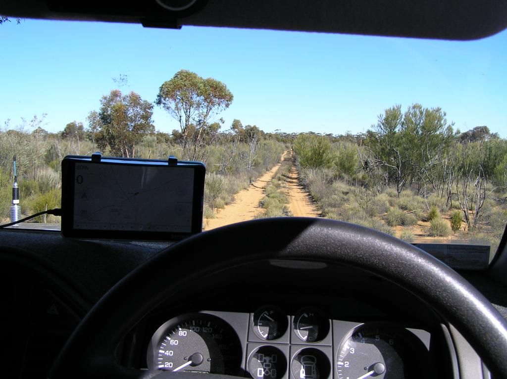
And the gps shot showing my track in red solid line, the benchmark 487 and how far I got past that:
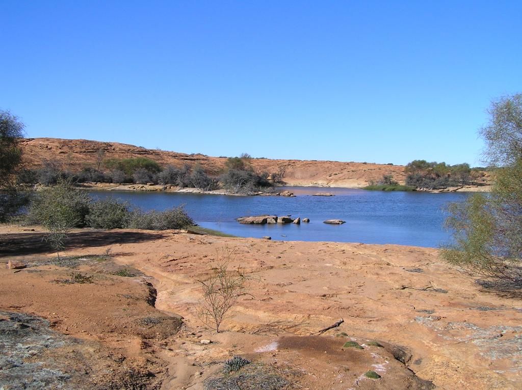
I'm making great progress down this newly selected road trying to limit my speed around the 80 Km/H mark as it was in truely remarkable condition. I could have hit much more speed if I wasn't careful. I come to another unmarked cross road. To the West is the entrance to a mine site, boom gates and security camera's to boot in the middle of nowhere. I continue on South noting I really need to head East to make my intended camp. When I get to the turnoff for the cache, there is another mine entrance on the Right. As I zoom out the gps map, I make the discovery I've been on Mt Walton Rd all along. I passed the start of this when I went into Jaurdi. It had big signposts: "no entry, private haul road" at its entrance. Whoops! So I turn East for Walleroo Rock. Magnificent country and boy am I rewarded at the end. A cache, a large water source at the rocks base and a magnificent campground to boot. It was a trifecta
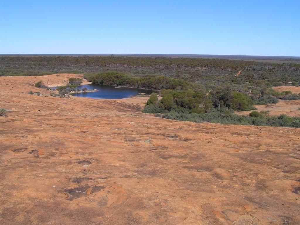
I have come to notice something out here after doing a bit of walking looking for caches. It doesn't take too much distance away from the vehicle to start to loose ones bearings in this thick scrub. I start to gain a feel for the recent spate of lost prospectors we seem to be having of late. After a bit of a look around Walleroo, I head out on the Eastern side of the Walleroo road. The road was open, traversing through low saltbush country in a soft yellow sand. I had about 40 Km's of this and it was just brilliant. Just myself, my paj, the scrub and quite literally, miles from anywhere or anybody.
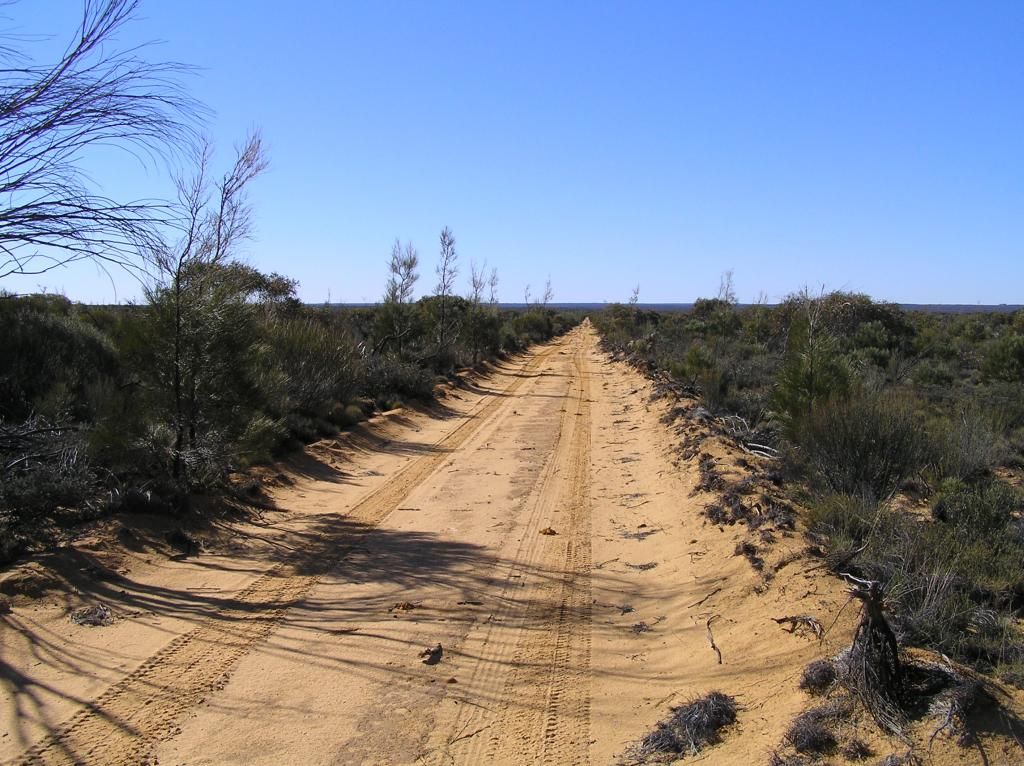
This stretch of track was my absolute favourite part of the whole trip. I cross another North/South road, but these seem to lead to nowhere special. Anyway I need to keep heading East, as Jaurdi Hills road is about 10 K's away and I need to hit this to get to Rowles Lagoon.
At this cross road, it must have been about 2pm, so it was time for another salami and jarlsberg cheese sandwich lunch. I soak up the cloudless sunshine and cool breeze in the process then continue East. The road changed a bit here, following a fenceline with a few minor water washouts and now I had scrub growing in the middle of the track. Obviously not as well used as the last 40 Km's. so I plug on, clearing the track of scrub with my bashplates. Coming past some old evidence of habitation I am greeted with a gate. All I can think is "oh shit", if this is locked, I'm buggered. As luck would have it, it was not, but once through and closing the gate I notice the BIG sign in the pic below. Another place I shouldn't have been in. But it wasn't signposted from the way I came in. Anyway, as my other half stated when I got back home, I wasn't entering, I was exiting.....lol

There is so much country out here, but so much of it is locked up. I guess that's what the money from gold does. So I'm now on an official gazetted road (the gravel Jaurdi Hills road) and I'm feeling a lot more confident about making Rowles for the night.
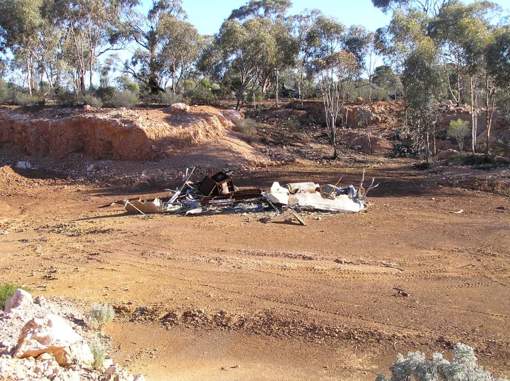
I'm making my way to the Coolgardie North road to set up camp at Rowles Lagoon. The remainder of the trip will be following the Golden Quest Discovery Trail, more or less. A quick right turn at Dunnsville and I spy some more potential diggings so I venture in for a look. It wasn't any diggings, but I am greeted with the remnants of a recently burnt out caravan. 2 large LPG cylinders are in the mix, luckily they hadn't let go. It had burnt completely to the ground, even the tires were now just radial strings of steel belts
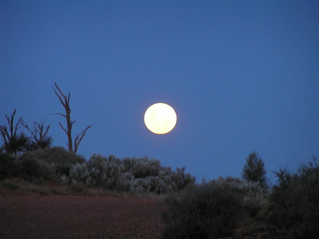
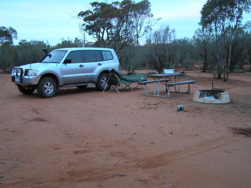
From there, there is nothing exciting to report on the rest of the journey, until I make my intended overnight destination - Rowles. Its about 4pm now so my first chore is to gather wood. The campsite is obviously well used and there is very little in the way of usable lumber. But just like at Jaurdi, I make do with what is available and scrounge enough both for dinner and a little after dinner drinks warmth. Just before I start the fire, I notice a large full moon rising behind me, so I grab a pic of both it and the campsite.
What I notice when I get home is that all my camp shots have about 4 empty cans on the ground and an enamel mug full of red. I think they were stalking me.....lol.
Another pleasant night in the swag and in the morning, I go for a 400m hike to pick up another cache for the trip. The lagoon is bone dry. Probably just as well as the cows that are now grazing on it cant swim. During the night the clouds rolled in. In the morning it was completely overcast and I never saw the sun all day. It remained this way for the remainder of the trip and threatened my security of a dry camp. I again go through the routine of packing up my gear, finish off with a bowl of cereal and hit the road. Next stop, Niagra Dam via leonora (or so I thought when I departed)
Heading up the Coolgardie North road I have a bit of a look around when I get to the ghost town of Callion. There are a couple of graves to look at, (not taking away from the hardships endured of days gone by, but I sort of get over looking at graves after a while). But on the other side is the abandoned pit of the old mine. This was the first major hole in the ground I had come across. And it makes me wonder........Mankind as a whole is such a funny race. We put so much effort and resource into digging up huge tracts of land to find a piddly amount of soft yellow metal. Then we base our world economies on this piece of metal.......pity we cant put the same efforts into solving some of the worlds problems hey!

Anyway, a bit off track there......I go and have a look at the pit. It is quite big and I wonder how many man hours it has taken to get to this. I would have loved to explore the area more, but time was pressing, so a couple of pics and I'm on the road again. I cant help but thinking that this mine rehabilitation business is a modern concept. So much land has been permanently destroyed by over more than a century of mining operations and I cant see any reason why this would be corrected in the future. I suppose, apart from the area's natural beauty (and mineral resource), there is probably not a lot going for it...If that's any justification???
I continue on and stop off at the remnants of the former township of Davyhurst. There is some caution to be exercised on these gravel roads, particularly in the lower lying regions and dips as water has eroded the subsoil leaving some big trenches in places in the road. Granite, one of the toughest rock known to man, and dumped as tailings from mining operations is crushed and rolled into the road in a lot of places. This gives the road surface some strength to endure water erosion and traffic, but its rough on the vehicle and I cant help but thinking I'd hate to be reincarnated as a cooper’s tire .
All that's left of Davyhurst is a bit of brick rubble from the former Grand Hotel and some associated bits of rusting metals and broken bottles floating about from occupation of days gone by. The bush has all but reclaimed the lot. Its a shame about these sites really, because there is nothing left now. Whilst I'm here I suppose I better bag myself another cache.
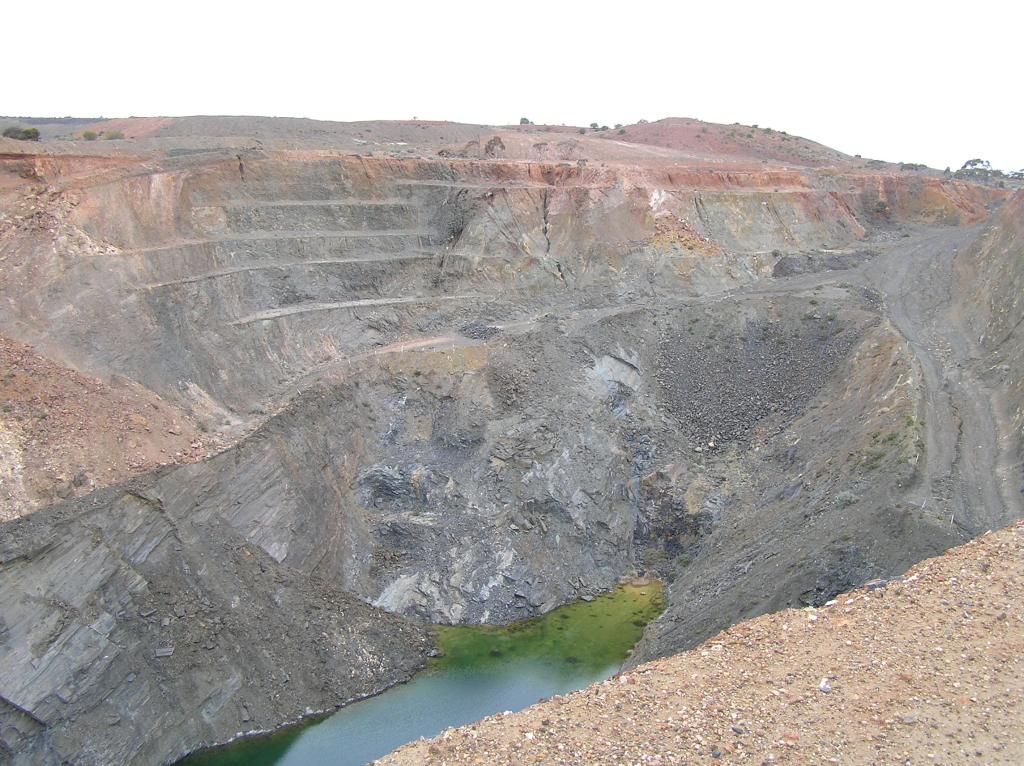
I can hear the whirr of an operating mine in the not to far distance, so there is obviously plenty of fortunes still to be found here. I again spy what looks like tailings and a pit in the distance, so I point the Paj in the general direction as far as I can and then walk over the granite tailings and discover a pit at least twice the size of the one at Callion, the abandoned Golden Eagle pit. But a word of note, its all relative. I haven't seen the super pit in Kal for years. It would make these look like potholes.
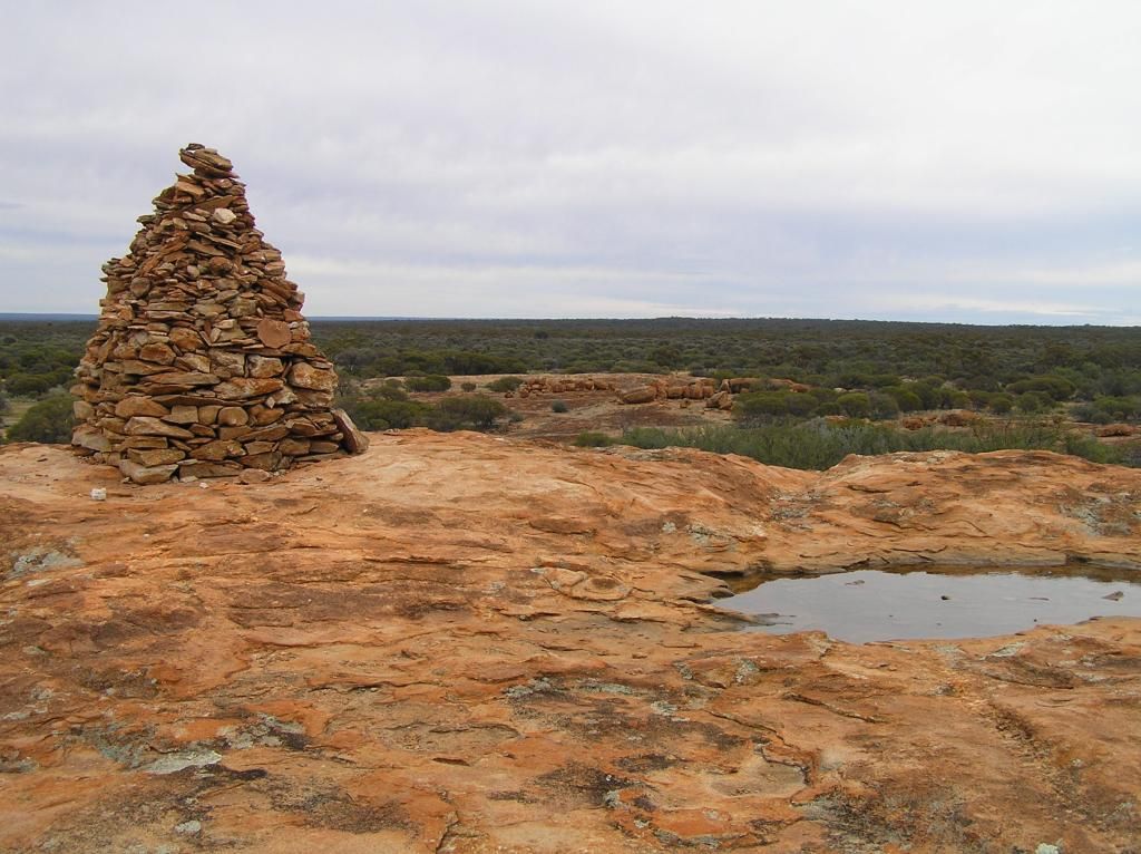
From there I head up to Ularring Soak. "First" discovered by one of this nations most adventurous men, Ernest Giles. Following up a lead when I returned home, I now have a paperback copy of his journal "Australia Twice Traversed" published in 1889. This is a Journal of Giles's 5 expeditions into WA and Central South Australia. I'm hoping I can glean some good information from this to go exploring into this area myself. He didn't have to deal with native title though, only spears....... I climbed the rock, grabed a pic of the cairn erected in his memory and go the staple salami and jarlsberg for lunch. I completely forgot about the cache here...D'oh!
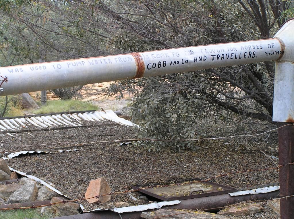
I find the well at Ularring pictured here of interest:
I push on to Snake Hill overlooking Lake Ballard. I've had to avoid 2 big reds on the way, but apart from that its been devoid of both wildlife and human interaction for the last 3 days. I haven't passed a single vehicle or seen another person since I left the Great Eastern Highway. Not that I'm anti human or anything, but I find this experience to be bloody fantastic.
I'm also starting to think there is no way I'm going to Niagra Dam for the last nights stop if I go via Leonora due to time and distance. I look at the nice covered picnic benches, then the dark grey clouds that have been around since Dawn. I'm thinking it would make nice protection should those clouds burst. But its only about 2.30pm and collecting timber may be a mission, having to drag it up the hill. So I decide to modify my plans. I'll head direct to Menzies then push on direct to Niagra. I turn into the Lake Ballard campsite (Gormley's inside Australia project)http://www.google.com.au/search?q=gormley+inside+australia&sa=X&tbm=isch&tbo=u&source=univ&ei=XC7OUeesGouCkwXV74DIBg&ved=0CDkQsAQ&biw=1013&bih=652)
Here I see my first people in 3 days. A couple of grey nomads in a small camp site. There is also no wood around. So, whilst I would have loved to have spent a day here, there is only so much you can fit into 4 days and the beckoning weather and firewood situation makes me stick with my recently modified plan.
Half of the 130 or so Km's from Lake Ballard to Niagra is dirt. Then at Menzies I hit the first load of tarmac in 3 days. So it's up the highway and into Niagra to be greeted with about 6 vans all camped up top. Great....NOT!. Oh dear, I've been enjoying the peace and solitude to date, but it looks like its all about to stop. So I drive past the nomads and find there is a dirt track to a lower campground. There is not a soul around down here....Perfect...... So I select a spot under some trees to provide me with some protection should the heaven's open during the night.

I do my usual task of gathering wood for the nights fire. Investigating some of the other fire pits, I find a bit of timber left from previous travellers. But I don't have enough, so I venture further afield, checking out what may lie underneath the scattered salmon gums. I bring back a few assorted "sticks" but its not looking great (that said, it's no different to the other two stops I had). I venture further out and have a Eureka gold strike all of my own.....Someone has left me some split jarrah sleepers. This is the best fire I will have all trip. But these sleepers will have to be used last as they have been soaked in diesel and they pretty well stunk and billowed smoke for a bit when they finally hit the fire. I bag another cache before dinner.
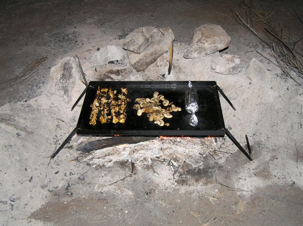
As it was to be my last supper, I thought I had better prove I didn't go hungry. Satay Chicken kebab's, mushrooms and corn on the cob. Slow cooked over an open fire on a Hilbilly hotplate. Top off with some coleslaw and pasta salad........Perfect bush tucker!
My best campfire to date was also my best night. After dinner and clean up was done, I sat back with the moshi bass barrel cranking out some tunes, listening to the genny and cackling female nomads camped above, the occasional rumble of a loco in the distance, singeing the hairs off my legs by the warn, cosy fire and quenching the dusty throat with some after dinner red. Light drizzle was falling on and off throughout the night. In the morning I am faced with the prospect of a 1000Km trek home.
So I pack up, have breakfast and hit the road for the long journey home. On the highway I'm amazed how wet the bitumen is and the small pools of water lying on the soil on the sides of the road. I was lucky it seems, the showers passed around me. I'm thinking to myself on the way back to Menzies, I really don't want to spend all my time home on the blacktop, but I'm torn between gravel and time. In the end I think stuff it, I don't want to go through Kalgoorlie and I'm out here for a reason, so bugger the time, I'll go to Coolgardie via Serbia and Ora Banda.
I turn off the highway back onto the dirt and travelling conditions are far removed from the day's before. In between showers, the road surface has turned to typical goldfields slush when wet. The paj is a bit skatey and I reduce my speed accordingly. Every time I hit a wet spot, I hear the road surface being flung under the guards and up the sides of the car.
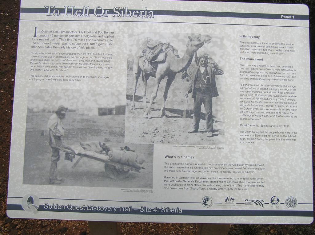
I rock up to Serbia and have a look at about the only thing left here. A cemetery. However the "Danger, numerous mines in the area" sign is too much of a lure, so I go for a 1/2 hour explore in the forbidden area. I cant believe the number of diggings here and pardon the pun, but I haven't even scratched the surface. Also what amazed me was the number of rusty old bully beef cans scattered around the area. Can you imagine living on that stuff - And here is me with my car, fridge, fresh steak, peri-peri chicken halves and satay kebabs, cold drinks, fresh salads and vege's. Boy, how times change hey. And not a barrow or a camel in sight. So I grab another cache and continue on.
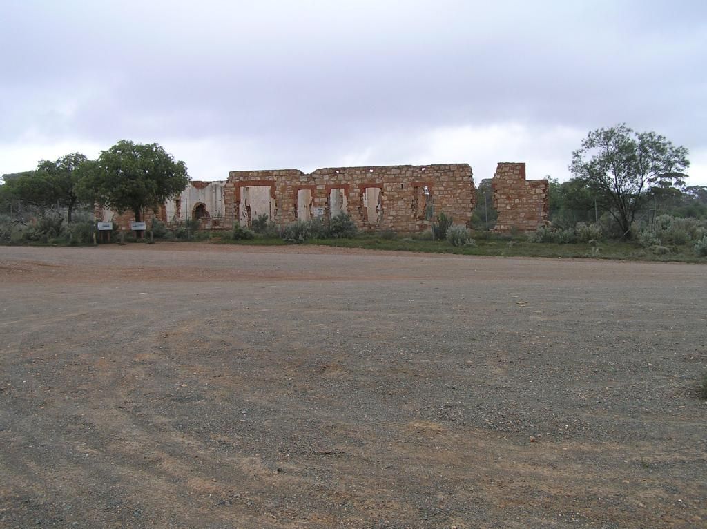
Anyway, time to finish up this epic....... So from Siberia, I make my way to Ora Banda but only pass through. I have to stop for a pic of the old hotel ruins in Kunanalling.
Then its off to Coolgardie to check in with the trouble and strife and back onto the blacktop for home.
Stopping at Southern Cross for fuel, re-aired tires and a well earned burger, I hit the road and get home 5 hours or so later.
So all in all, I travelled 1900Km's (800 of that dirt) over 4 days, burnt $300 worth of diesel and had one of my most enjoyable trips ever. I'm not sure why I enjoyed it so much - It could have been that I was solo, I travelled some lonely bush tracks, I saw no people for 3 days or I took in a lot of history. Maybe it was because I had left the city behind. In reflection, I think it was just simply all the above.
Anyway, hope you enjoyed the read as much as I enjoyed the sharing.