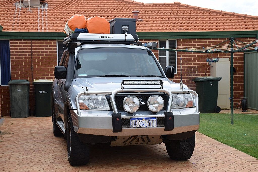
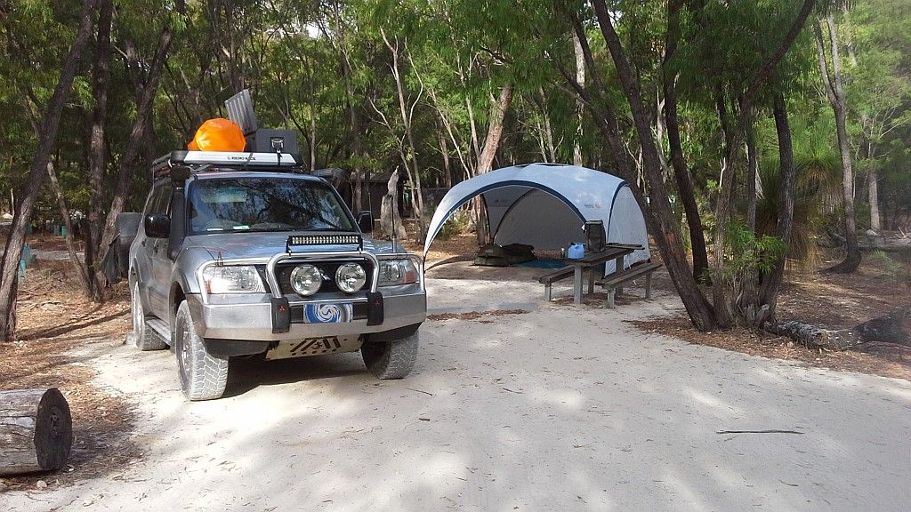
Following on from Part I, the next weekend I also had a 3 dayer. This time I went North up to the old favourite, Sandy Cape. So I now have my 2015 tally of nights under canvas at 6. Likewise I also had a 1pm finish, so I could stretch that 3 days into 4. Unfortunately, this time the departure day was a Saturday. I knew it was going to be busy at the camp by 3pm and I was not to be corrected. The place was heaving. The main site was all but full. I went for a look at the upper camp site. Whilst there were a few places I could spend the night, the wind was pretty stiff and the sand was blowing around. It would have been an uncomfortable night. And it wasn't my preferred location.
So back to the main camp. Having a chat with the caretaker, he said I could squeeze in behind his van. And that's what I did. I was pretty sure most would leave tomorrow anyway, so I would re-evaluate my accommodations then.

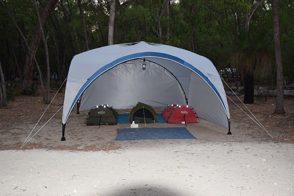
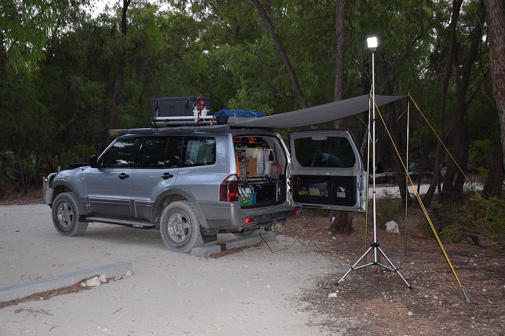
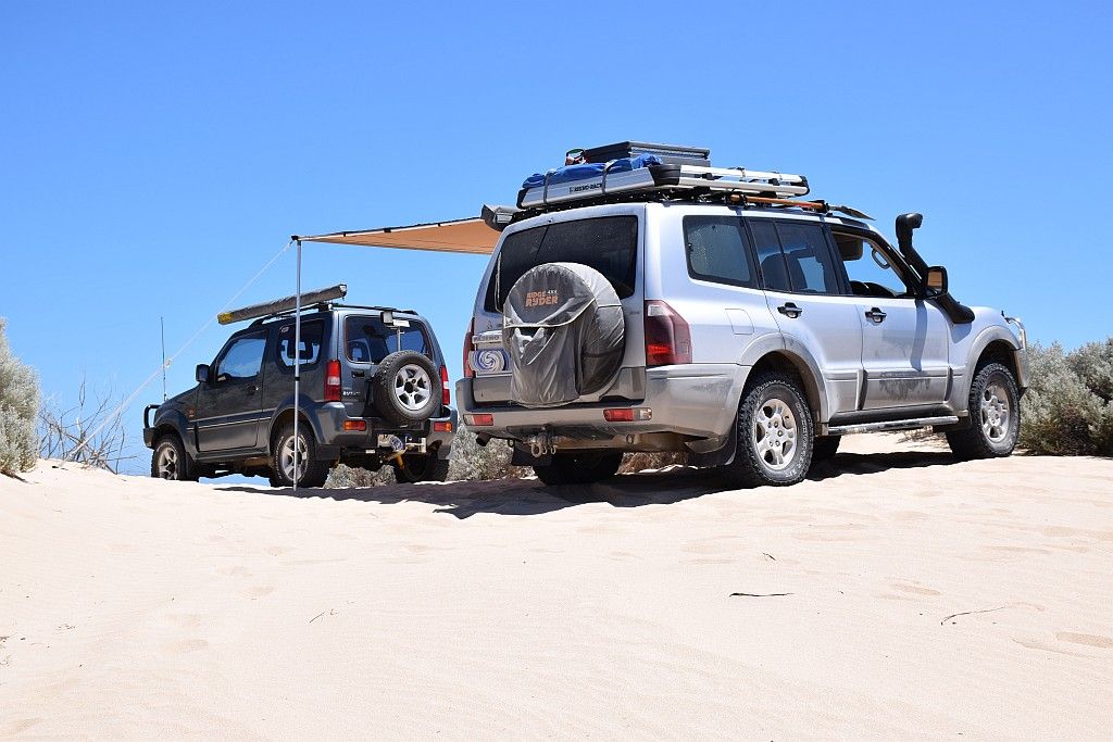
The night itself was an uneventful affair considering the amount of people in camp. It blew pretty hard and I put additional guys on the awning, secured with 500mm sand pegs. In fact, the wind never stopped all weekend, which was a bit of a bugger really. But I suppose it kept the flys at bay. A few reds after dinner and a play with the camera on the setting moon/stars and it was lights out.

Sunday morning and I had to decide to leave the gear set up, or pack it away. I chose the latter, as if I moved that night, then it all had to be packed up anyway. I took a walk down to the beach prior to breakfast. A nice way to spend the morning.

Green Head can be seen on the other side of the bay. About 30Km's by road. Maybe 10Km's as the crow flies. The wind chop was to be the feature of the weekend. it just never let up unfortunately.

A popular beach for launching the tinnie. As can be seen from the picture above though, they never ventured too far. In fact, last time I was here, I had the yak out further. This time however, the yak never made it off the roof rack.

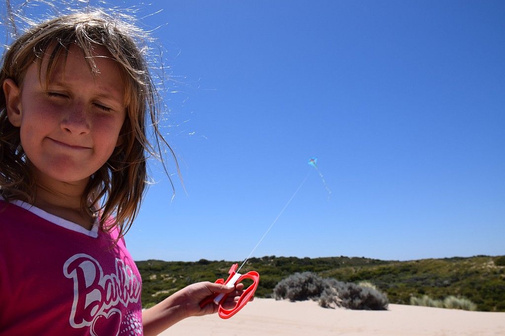
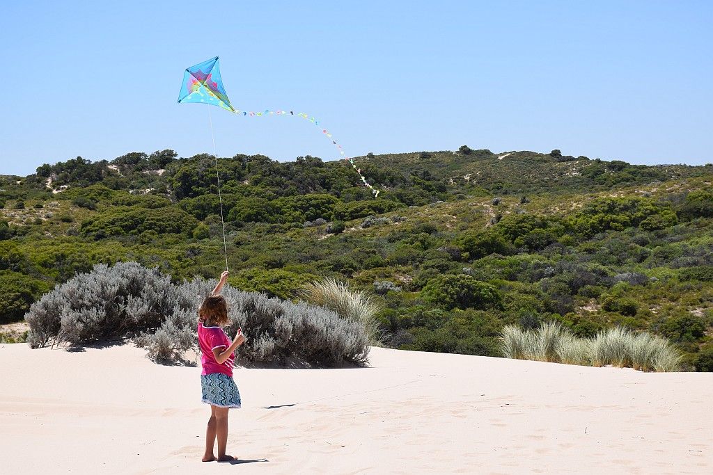
The beach itself is surrounded by some big dunes on the Southern side. These are a magnet for kids entertainment. And adults too, I might add.

A late departure and I was off, destination Stockyard Gully (one of my favourite places in the area). I took the long way around to pick up a cache at the Lions lookout. I can now add some orange colour to the limestone coloured dust I have collected over the last two weekends.

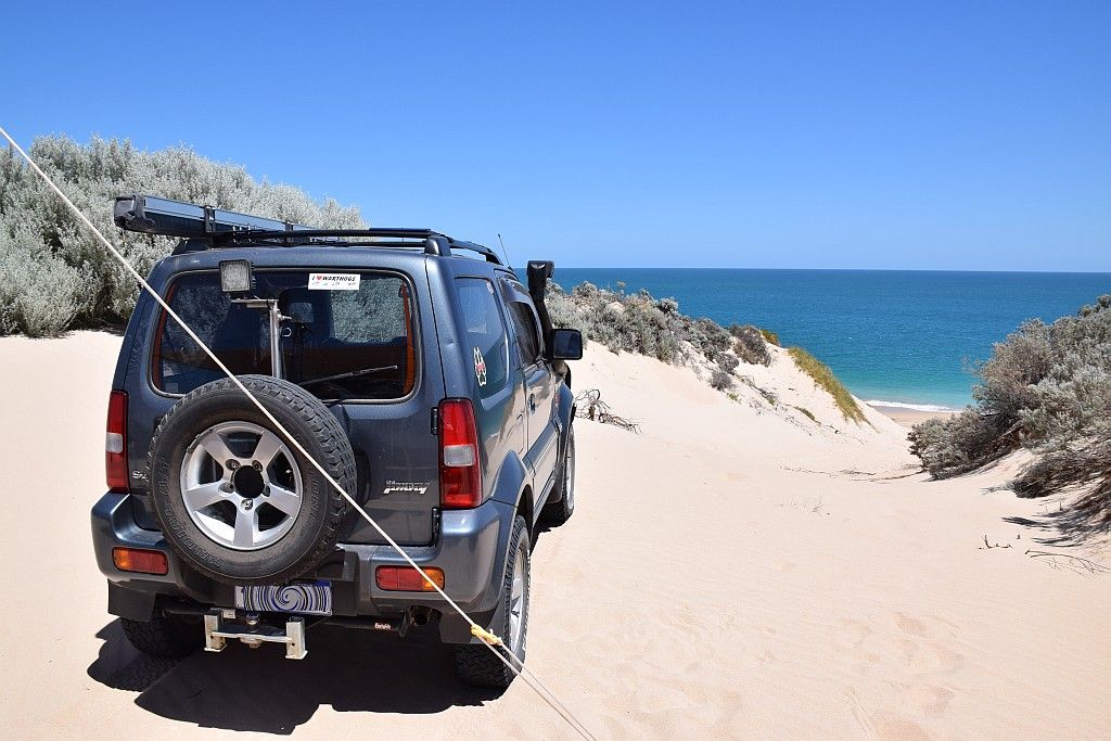
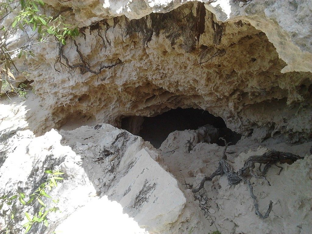
Not far from the turn off, I spied a cave on the moving map, not too far from the road. So I cruised by slowly, hoping to pick the track to lead me there. I subsequently found the track and headed North. A couple of hundred meters in and this track turned to very soft sand. Here I was on road pressures, trying to keep momentum, fearing the worst had I stopped. Quickly flicking into 4H lock and disabling the ASC to give me the best chance of not having to dig. It was too hot to be digging and recovering anyway. The track seemed to vere away from the marked route on the map. It was also taking me away from the cave. As I didn't want to be ginning around deflating and reflating, and I had a bigger mission to accomplish, I made an on the spot decision to abort. Problem being where to abort. If I had stopped where I was, I may have been stopped for an extended duration with the shovel and max trax. So I plugged on, hard tyres and on a wing and a prayer, hoping to find a decent place for a turn back. The decent place never came, but I stopped on a crest at a second rate alternative. Whilst it was close to being a fail, I endured and got heading back to the road. I had to switch to low as once stopped, I didn't have the berries in high to overcome the soft sand that was sucking the coopers, trying with all its might to stop them from rotating. So recovery averted, I continued onto Stockyard.
Crossing Cockleshell Gully, I poked my nose down a track. Unfortunately, a hundred meters down the road was a DPAW signpost stating Authorised vehicles only, clean off soil ETC and so forth. So another turn back. I made my way to the start of the "Rough Road" track into Stockyard. Not that its rough, a bit sandy and some limestone cap rock. Political correctness I suppose. It might stop those in the family sedan from attempting it???? But the problem with signs seems to be that people cant read them. And they are a magnet for projectiles for some reason.


Their is not a lot of history I can find on these caves, however I provide the following;
During the mid-late 1900’s, part of the coastal stock route, linking Champion Bay (Geraldton) and the Guildford cattle markets traversed the National Park the cave is located in. Stockmen found the area provided good feed and water for the animals, and the creek bed or gully near the inflow entrance to the cave formed a narrow holding yard for stock if they needed to camp overnight.
And for the spelio among us:
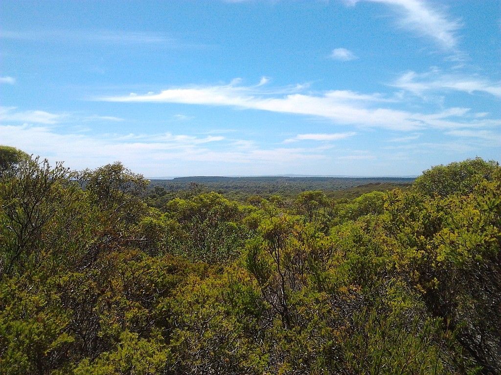
This area extends from the Green Head Road in the south to the Irwin River in the north. The area first received attention from speleologists when W.A.S.G. explored River and Arramall Caves in 1960.
In 1963, Jennings visited the Stockyard Gully caves. On this trip E 1 to E 10 were described and positioned. Of these, Stockyard Bridge, Stockyard Tunnel and Stockyard Cave, together with Aiyennu Cave and Beekeepers Hole were the most significant.
In 1969, D.C. & J.W.J Lowry squeezed through a rockfall in Weelawadji Cave and added 1700 m of passageway to the known 300 m of cave (Lowry 1969). Since this discovery, only the extension of Beekeepers Hole (also known as Uniwa Cave) to 1.4km from 250m has been the major find in this area.
Before too long, I was at the top car park, ready to bag another cache. Surprisingly, being a Sunday there was only one other vehicle here, a dark 100 series cruiser. There are two caches here one being a virtual cache. I fired up the GPS to bag the normal one. heading across the road, the Vista HCx in hand, A voice shouts out "so you're looking for the cache huh!". So much for trying to keep a low profile, I was sprung only 10 meters from the car. I went over and we had a chat for a bit. The person was an avid cacher herself, Dimor. She had just logged the find I was about to retrieve. We chatted about caching and places we had travelled to. They headed off for the bottom car park to do the cave, I grabbed the cache and had some lunch, then also headed for the bottom car park and the cave.
The river valley is in complete contrast to the surrounding sand plain heath. Huge gums line the waterway. It is so picturesque down here and remarkably cooler to boot.

The feral beehives are still fairly active, high on the cliff faces above the entrances. There were a few notes in these caches I was doing about a month back that the bees were a bit aggressive. I didn't find that to be the case. I don't recall seeing a single bee at ground level. So all is good.

And then I made my way into the cave itself. The roof structure is impressive with its gnarly eroded roof. And it provides welcome relief from the temperature up top, which was a reasonably warm mid 30's today.

Passing the first bend and then you enter total darkness. About midway, I catch up with Dimor and geo hubby. We chat again, all things caching, for about 1/2 hour in the pleasant coolness under lantern and headlamp light in the middle of the cave. We bid or farewells, Dimor going out, myself going onwards. Great to meet you and geo hubby. Maybe we will again some day.
There is a structure about mid way, I name "The Tonsil". If you ever had a torch extinguish whilst in there, this Tonsil will give you a sore head.

Getting closer to the other entrance, an orange glow starts to appear, the rays of sunlight trying their hardest to penetrate inside.

And pretty soon after that you know the end is nigh
So I cant think of a better place to take a selfie. I warned you in the East of Esperance entry that my new found skill was going to be detrimental to my audiences sanity.

I know from my last trip here there are two caves. I went to both last time. The ranger also told me back then there is a third one further up river. It has a lot more rock hopping/climbing involved and isn't accessible to the public. Maybe one day, I might try to get the Rangers permission to check that one out. I do like this place, it is my most favourite sites in the area. I must come back here when there is water in the creek.
By now it is late afternoon. I was going to go out to Lake Indoon for another cache, but decided it was too hot and it was beer o'clock. So back to camp I went.

As luck would have it, I passed two camper trailers that I know had been in my most favoured site the night before. I was correct, being late Sunday afternoon, the camp had almost emptied and I scored my prized location.


The afternoon spent getting camp set up once again and making preparations for dinner. After the sun had set, I took a stroll down the beach and had another play with the camera. I got a couple of nice post sunset shots with a setting moon over the bay. I cant decide which one is my favourite:

or:

I also grabbed one down at the waters edge. Unfortunately I missed the moon in that one as an unexpected wave came a bit higher than I thought, wet my feet and spoiled the framing .It doesn't grab my attention like the top two though. I must say, even though I still haven't put the time into learning how to drive the new camera, I am surprised at some of the results. I don't think the old point and shoot produces shots as nice, particularly in lower light.

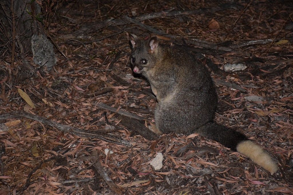
The night before bed was a quiet affair. Only thing of interest was sitting quietly with a mug of red (I don't believe in glasses, you cant fit enough in them...Lol). A sneaky old fox started to creep up on me. About 10m away, I sat up in the chair and reached for the mug. Wish I had a camera to record that foxes face when he realised there was someone there. He was not seen again.
The wind had started to abate during the night until about 0300. Then all hell broke loose. One could think that TC Marcia had crossed the continent and was now passing over the WA coast. Very strong gusts, making a rip roaring noise through the tree canopy followed by moments of absolutely nothing and total silence. this went on until about 0600, when I finally got back to sleep. I really do not know how the side awning survived. I was fully prepared to have to cut it off. I would have had no chance of folding it back up if it had failed.
So due to the lack of sleep, I awoke again about 0900. Rolling out the swag, coffee's on the beach watching the scenery and finally getting the motivation to cook breakfast. Another late start and I made my way to the headland to the South of the camp for the first one "Jurien Shack legacy". This (and the campsite I am now using) was the site of squatters shacks from the early 70's to 2001. Inside the cache were some amazing photo's of the old village. Back at home I have emailed the cache owner and have his permission to reproduce a couple of those shots:


Now its just a barren headland, rarely used. You could camp here I suppose, but the beachfront real estate is very unprotected and you would certainly need to pick your weather.
In regards to squatters shacks, its been a tradition here in WA. Maybe so due to the lack of development compared to the East Coast. Its also been a tradition that the Government of many terms and political persuasion have hated them with a passion. They have been slowly been passing legislation to have these demolished. In some areas I can accept that. Sandy Cape campsite only exists due to the fact the squatters were moved out.
However, in most places it seems that the government just has a plain hate relationship with them. The cache location a perfect example. Now just barren unused ground, still undeveloped since the shacks removal in 2001, the shack owners have been driven out for no good reason. The government (both local and state) tend to use the excuses of environmental and building code issues. The environmental one does have some merit I suppose, there is always a lot of evidence of former occupation at these sites, but if they want to use that as a valid excuse, then they should have remediated the site when the shacks were cleared. I feel that most of it is just a cop out.
Here I quote an excerpt of a submission from DEC to a Parliamentary Standing Committee on the WA shack issue back in 2010:
Squatter shacks have been confined to small coastal locations where farmers and
city dwellers erected opportunistic and makeshift dwellings for annual holidays, and
where professional fishers set up bases close to fishing grounds and good anchorage.
As recreational use of the coast increased, larger numbers of squatter shacks were
erected and the State Government determined that a policy for the administration and
removal of illegally erected squatter shacks should be prepared. The State Government
Squatter Policy was formulated in 1987 and formally adopted as Government policy in 1989.
The policy was developed by the former Department of Land Administration and is derived
from and enforces, section 164 of the Land Act 1933, which relates to offences on public lands (now the Land Administration Act 1997, sections 270-273).
Under the Squatter Policy, 678 shacks have been removed including:
• 138 shacks in the Shire of Coorow;
• about 240 in the Shire of Carnamah;
• 130 in the Shire of Irwin; and
• 170 shacks in the Shire of Dandaragan near Jurien Bay.
The most recent removal of 170 shacks from Jurien Bay in 2001 enabled development of the popular Sandy Cape recreation area that provides basic amenities for camping, caravanning and day visitors. Likewise shack removal in the Shire of Coorow in 1994 enabled development of a coastal drive and series of recreational sites adjacent to Greenhead.
Professional fisher shacks are a recognised exemption from the policy and generally
are permitted to remain.
So why are Professional Fishers given preferential treatment? Personally, I think there is a need on environmental grounds for improvement. But a blanket policy on removal? Current shack villages at Wedge island and Grey even pay rates. But their time there is numbered if the government has its way. Bulldoze the lot and get a developer in to build holiday accommodation is their philosophy.
To end my soap box rant, I include another photo from Pat, the owner of the cache. A sad end to a loss of heritage. The picture is from 2001 and is the bonfire being fed with the shacks that have just been destroyed.

But the cache must go on and I head up to Green Head. I pick up one of those pesky micro's (about 10mm in diameter and the same in length at a set of Seal sculptures;


Then into town I grab another.

Looking back towards Sandy Cape:

I then head up the coast picking up caches as I go. I also took Kahu the Courageous Kiwi trackable to move onto another cache:

It is quite hot today. So much so, I decide when I find a weed free bay I will have a swim. I get up as far as Deception Bay and find a couple of shacks that are yet to meet their fate. Going by the jetty, they just may be of those protected variety.


I spend too long in the hot sun on the beach looking for this cache. A willy willy comes over a dune, the sand removing 3 layers of epidermis from me and coating me like a lammington in fine sand, stuck to my dripping sweat. That is the final straw, I call the cache a DNF and head back to the luxury of the fridge in the car. The swim I longed for didn't happen either. All the bays were very shallow and the water full of churned up weed. I'll have a swim when I get back to camp. Or so I thought.
The wind today has obviously been from a different direction and now the bay at camp is also full of churned up weed. There goes the swim. So I have to resort to the bush shower. I think the birds enjoyed the shower as much as I did:

The rest of the last day was spent replenishing my lost fluids with the aid of a can from the fridge. Just a relaxing afternoon really. Dinner follows then bed. The following day, its chuck all the gear in the car for the 2 hour drive home. The next week, spent packing all the said gear away and cleaning the car.

Once home I find quite a few insect bites have started to emerge. They have been quite itchy. Then as I start to write this entry, I feel something crawling in my hair. I flick it out and find its a large tick. I had some suspicions about those bites and now I have it confirmed. I'm not sure where I picked them up, but I suspect it was from bush bashing in part I out to the lime tunnels. I must have picked up quite a few going by all the itchy lumps and bumps I now have to cart around.
Talk about unlucky. Blown out for 3 days, not being able to remove the yak from the rack. Then on Wednesday morning, a run out to Fremantle for work and its a glass off.

However, I now have the nights under canvas tally underway, so it hasn't been all bad. March will be a non event for me, but in April I will hit it with a vengance. Stay tuned.
And a big thank you to Pat the owner of "Jurien Shack legacy" for allowing me to reproduce his personal photographs in the name of lost heritage.